Poster Map Print
Poster Map Print
Mounted on foam board
20 x 30
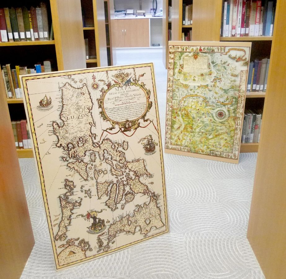
1. Murillo Velarde Philippine Map - a 1734 map by Fr. Pedro Murillo Velarde, it is the high point in cartographic heritage, joining Spanish science and Filipino artistry. This map includes the shoal originally called Panacot, today known as Panatag (or Scarborough). It would later be renamed to Bajo de Masinloc, showing its connection to the Zambales town of the same name.
2. Fort McKinley Map - a 1928 map of now known Bonifacio Global City depicting the life in the former American military base and the surrounding towns and people. Vignettes surround the poster, depicting Philippine history from a racist albeit silly point of view. Available poster mounted on foam board.
P 1500.00